Friday, 29 August 2014

Leica Viva GS08plus - Lightest cable-free high-accuracy GNSS system


Leica Viva GS08plus - Lightest cable-free high-accuracy GNSS system

Leica Geosystems has developed a new GNSS solution to its successful Viva GNSS family. The Leica Viva GS08plus is the smallest and lightest cable-free high-accuracy GNSS system. Being light weight and ideally balanced, the Leica Viva GS08plus delivers ergonomic use for a wide range of surveying tasks.

Offering flexible setup options and equipped with the easy-to-use Leica SmartWorx Viva LT onboard software, the Leica Viva GS08plus allows professionals from many industries affordable entry into dual-frequency RTK surveying from a premium manufacturer.

Smallest and lightest, cable-free high-accuracy GNSS solution
The compact Leica Viva GS08plus SmartAntenna together with Leica Viva CS10 controller on a carbon telescopic pole weighs only 2.6 kg. Users profit from a completely cable-free ergonomic GNSS solution that is comfortable to carry for a full working day.

Proven Leica Geosystems GNSS Technology
Built on years of knowledge and experience, Leica Viva GS08plus delivers the hallmarks of Leica GNSS – reliability and accuracy. All Leica Viva GNSS are now green signifying their high quality also in the GNSS mid-range segment.

With SmartTrack and SmartCheck integrated, the Leica Viva GS08plus tracks signals with the highest quality and constantly evaluates and verifies the RTK solution to ensure the most reliable RTK positions for complete peace-of-mind.

Flexible Setup and Communications
Leica Viva GS08plus offers flexible wireless RTK communication and setups. The Leica Viva CS10 controller includes mobile broadband for high-speed internet connection to receive RTK corrections. At times when no RTK internet corrections are available, the CS10 controller can be easily equipped with a UHF radio to receive RTK corrections from a local base station. For full flexibility, the Leica Viva GS08plus itself can be deployed as a local base station.

Quick to Learn with Leica SmartWorx Viva LT
SmartWorx Viva LT is designed with simplicity in mind using clear graphics, logical menu structures, non-technical terminology and simplified workflows. The onboard software allows users to productively complete their surveying tasks within a minimum of time.


Click here for more information on the Leica Viva GS08plus


Cable Detection EZiCAT i700 with GPS Positioning


Cable Detection has recently launched a new range of digital cable avoidance tools integrating high precision location technology with GPS tracking functionality, the Cable Detection EZiCAT i700 series.

When undertaking a survey of a site before construction commences, accurate geographical location of detected services will need to be recorded.

A safe system of work prescribes the use of a locating device before any kind of excavation takes place. Obtaining accurate information about the location of buried utilities is the fundamental part to protect employees and equipment during any excavation project.

Ensuring the right location has been effectively searched and records of buried services are recorded correctly. With the Cable Detection EZiCAT i700 series, both detection and geographical location can be stored digitally.

The Cable Detection EZiCAT i700 range comprises of:
EZiCAT i700
A high precision digital cable locator incorporating GPS geographical location, memory for data-logging and Bluetooth connectivity.

EZiCAT i750
Locator with memory, Bluetooth, GPS and Depth estimation.

EZiCAT i750xf
Locator with memory, Bluetooth, GPS, Depth estimation, Current Indication and additional 512 & 640Hz tracing frequencies.

GPS Positioning
The intelligent Cable Detection EZiCAT i700, EZiCAT i750, EZiCAT i750xf are the first cable locators to feature fully integrated internal GPS technology, which is used to record the geographical position of use. The geographical position (Latitude and Longitude) is stored in the log file and provides information on where the locator was used.

This information can then be transferred via Bluetooth to LOGiCAT software, making downloading and analysing the data quick and easy. This data is useful to help identify training needs of users and for traceability of locating following a near miss, utility strike or similar incident.

Upon start-up, the Cable Detection EZiCAT i700 will undertake an internal start-up test all functionality including allowing the internal GPS module time to search for a GPS position.

Automatic Pinpointing
The EZiCAT i700 has all the well-known features you need to locate buried utilities effectively, along with the unique 'Automatic Pinpointing' feature which makes locating buried cables and pipes easy and simple. You don't need to manually adjust the sensitivity of the locator because the intelligent locator does this for you. Ensuring that you are using the optimum sensitivity for the environment you are locating in.


Features of the Cable Detection EZiCAT i700 range

Starts in Power Mode
Ensuring the most potentially dangerous current carrying utilities are detected first for maximum operator safety.

Mode Lock
xf models start in the last mode of operation at maximum sensitivity simplifying the survey process. Mode lock can be switched off enabling a Power mode start up for avoidance users.

Automatic controls
Making the EZiCAT easy to use, requiring minimal user experience.

Hazard Zone
The new feature which indicates the presence of a shallow buried utility in power, 8 and 33 kHz modes, (within approximately 30cm) alerting users to the increased risk.

High contrast LCD screen
With built-in light sensor, automatically enabling the backlight in dark conditions.

Signal Strength Indication (SSI)
EZiCAT locators feature numeric signal strength readout, specifically designed for easy Sonde location and use with EZiCAT to identify an underground utility.

Pinpoint Assist
Maintains the highest peak reading obtained on the signal strength indicator for a period of time, allowing the operator to quickly and accurately pinpoint the utility position.

Depth Indication (available on the i750 and i750xf models only)
When using the EZiCAT in conjunction with the EZiTEX signal transmitter or Sonde, operators can determine the depth of the buried utility, providing a clear advantage when conducting ground surveys.

Current Indication – (available on 750xf only)
Current measurement displayed following a depth reading. The current measurement helps to identify the utility to which the Ezitex signal transmitter is attached to.

Data logging
The EZiCAT i700 series locators’ record and store information whilst they are in use. The locators start to record information every second after completion of the initial start-up routine. These records (logs) are stored in the locators’ memory and can be retrieved and transferred via Bluetooth to a PC for analysis.

Bluetooth Connectivity
All of the EZiCAT i700 series locators have the added benefit of Bluetooth wireless connectivity. It allows the EZiCAT to integrate seamlessly with mobile mapping technology to log survey data, in addition to enabling wireless Bluetooth data transfer.

LOGiCAT
Allows you to upload the stored records to view the locators use, simply upload all records or search by date.

In-built test function
Allowing operators to test the hardware and software functionality of the EZiCAT before use.

Service Due Indicator
Supporting customer planned maintenance schedules or quality systems by displaying a wrench icon after 12 months.


For more information on the Cable Detection EZICAT i700, EZiCAT i750, EZiCAT i750xf, click here


Thursday, 10 July 2014

Tell Tale Crack Monitor


Tell Tale Crack Monitor

Cracks often appear in a building. They may be just hairline cracks and of little significance or they may the first sign of a serious defect.

The crack may not increase in width and therefore would be static. However it may progressively increase in width over time. This progressive movement may suggest there is a serious defect in the foundations and / or the superstructure.

Monitoring and recording progressive changes in the width of the crack over time will confirm or otherwise the nature of the defect and assist with diagnosing the cause.

Sometimes cracks will open and then partially close, and then open again before partially closing again following a cyclic pattern of movement. Again monitoring and recording the changes of width over time and perhaps correlating the crack movements with external factors will assist with identifying the cause.


How To Monitor A Crack
Monitoring in isolation to any other investigation will rarely provide sufficient information to fully diagnose the cause of cracks. But it will indicate how the building is deforming and the rate at which movement is occurring. The results of the monitoring are a vital ingredient for diagnosing the cause.

Because crack monitoring takes time, it is essential it starts at the earliest opportunity and continues throughout the period of inspections and investigations. In some instances it can be continued to validate the remedial work.

A simple device called Avongard Tell Tale can be placed over the crack. This would provide precision monitoring the progressive width and indicate the direction of movement both horizontal and vertical movement.

The Avongard Tell Tale features two plates which overlap, the bottom plate contains a calibrated grid in millimeters with the top transparent plate containing precision cross hair which slides over the grid and shows any movement.


A detailed positive or negative reading can be read from the position of the cross hair on the graduation of the underlying grid to an accuracy of +/- 1.0mm and by interpolation to +/-0.5mm.

Avongard provide a crack recording sheet with every instrument to allow the surveyor to accurately record the position of the cross hairs on the opposing grid, building a pattern of movement over a period of time.

Application example
A useful application of using Tell Tales for crack monitoring would be illustrated by the following scenario:

An existing building is to be demolished to make way for a new development. There are existing buildings either side. Before demolition starts, the owner or the advisers of the building to be demolished inspects with the owners of the adjoining buildings any cracks in their buildings.

The widths of the cracks are measured using an Avongard Crack Width Gauge as part of the present condition survey and Tell Tales are fixed across any cracks.

The position and reading of each Tell Tale are agreed with all interested parties. All interested parties countersign the crack monitoring sheet. At agreed stages during the demolition, foundation and superstructure construction, all interested parties again read the Tell Tales for signs of movement and countersign the crack monitoring sheet. This procedure can reduce the incidence of disputes and claims with adjoining owners.


If you have a requirement for measuring a crack in a building or structure or even a concrete floor, visit our range of Avongard crack monitoring tell tales


Monday, 23 June 2014

Approved Crowcon Gas Monitor Dealer


Approved Crowcon Gas Monitor Dealer

Survey Express Services are the UK’s leading Crowcon approved dealer and authorised service center.

All equipment within the Crowcon range is available through our 6 regional offices employing fully trained service technicians who are Crowcon trained and approved to undertake all servicing and repair tasks.

Survey Express Services have been dealers for over 20 years and during this time accumulated first-hand experience in Crowcon’s superb range of personnel gas monitors.

Like our customer’s, Survey Express Services appreciate Crowcon gas monitors for their reliability, low cost of ownership and functionality in arduous environments.


We operate a hire fleet containing hundreds of Crowcon units, all supported by our service team maintaining these instruments to optimal performance.

If you are looking for a standard confined space Crowcon gas monitor, we hold these in stock. However, if your requirements are for more exotic gases like PID/VOC, chlorine and ammonia gases, we hold a specialist fleet ready for hire.

Chlorine is often utilised within the water industry to remove contaminants, so requiring personnel gas monitors with 5 gas sensors which we provide.

If you have a requirement for gas monitors or need a professional service center to manage your fleet, please contact your nearest office

Check out our extensive range of personnel gas monitors or if you have a requirement for servicing, please contact our service center


Wednesday, 28 May 2014

Leica DISTO D110 - Launch of the World's Smallest Distance Laser


Leica DISTO D110 - Smallest Distance Laser

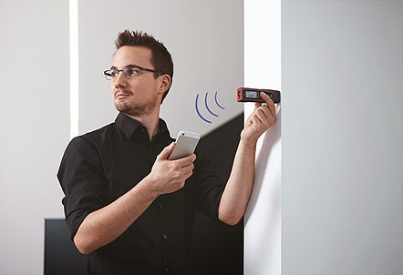
Leica Geosystems has recently launched a new small, compact laser measuring instruments, Leica DISTO D110, the world’s smallest laser distance meter with integrated Bluetooth Smart technology.

The Leica DISTO D110 is world’s smallest laser distance meter with integrated Bluetooth Smart technology. By using its precise measurements users can create floor plans and sketch easily by connecting it with the Leica DISTO sketch app on a smartphone or a tablet. Whether an interior designer, painter or building contractor, the Leica DISTO D110 will make it easier to get the job done right.

The precise and affordable laser distance meter is hassle-free and strikingly simple to use making it possible for anyone to measure distances or areas.

With the device being so intuitive to use it is easy to focus on the actual job: creating room and floor plans, building drywall, painting, making material estimations, renovating and many more.


Compact design and simple functions make the Leica DISTO D110 a perfect tool for everyday indoor measuring tasks. With the removable pocket clip accessory it is possible to clip the device to a belt or a pocket for direct access.

Compact shape and intuitive ease of use
The Leica DISTO D110 ergonomic design guarantees that the device fits perfectly in a hand and is comfortable to use. The self-explanatory buttons allow quick and intuitive operation. Measuring has never been easier!


Leica DISTO D110 measuring a factory unit


Easy data transfer to Leica DISTO sketch app with Bluetooth Smart technology
Users can take advantage of additional features by downloading the free Leica DISTO sketch app on a smartphone or a tablet. Bluetooth Smart allows transferring measurements from the laser distance meter directly to the Leica DISTO sketch app.

Leica DISTO D110 linked via Bluetooth to an Apple IPhone


Once the Leica DISTO D110 is connected to compatible devices, users can instantly start creating floor plans, sketches and photo-documentation with precise measurements. It is even possible to integrate detailed sketches to existing plans. All documents are saved in the app and can be send by e-mail to make them quickly available.

Connect the Leica DISTO D110 to a range of smartphones and tables


Proven accuracy and quality from Leica Geosystems
As inventor of the handheld laser distance meter, Leica Geosystems has built customer trust from many years of expertise. The Leica DISTO D110 builds upon this heritage with an accuracy of ±1.5 mm and a measuring range up to 60m according to the ISO standard 16331-1, lifetime manufacturer’s warranty and no cost period up to 3 years, the Leica DISTO D110 delivers outstanding performance at a great value.


Thursday, 10 April 2014

Protimeter Aquant2 - Non Invasive Moisture Meter


GE Measurement & Control has updated their non-invasive moisture meter, the Protimeter Aquant2.

The Protimeter Aquant has been in demand from surveyors, building engineers and estate agents due to its accurate non-invasive moisture readings. This allows moisture readings to be recorded below the surface without damaging the surface from metal pins.

The Protimeter Aquant2 has been designed around a newly developed ergonomic case that provides clearer readings and a reassuring grip of the instrument. The instruments larger digital LCD backlit screen, eliminates the moisture readings supported by 60 coloured LEDs depicting the severity of the moisture reading.


Search Mode—Non-Invasive
The search mode is used to assess the moisture level beneath the surface of solid walls and floors independently of surface conditions. When held against the surface, the instrument transmits a signal into the material. The relative moisture level is shown on the digital display and its moisture condition is shown on the accompanying scale of color-coded lights.

The search model allows the user to undertake moisture readings quickly, easily and more important accurately.

The Protimeter Aquant2 is the ideal instrument for non-invasive rapid moisture testing of building elements such as solid walls and floors prior to more rigorous and time-consuming investigative procedures that may be required.

Click for more information on the Protimeter Aquant2


Protimeter Surveymaster - Just Got Better!

Protimeter Surveymaster moisture meter


GE Measurement & Control has launched its powerful new detection instrument, the Protimeter Surveymaster. With dual measuring functions, professionals can assess the moisture conditions with the confidence that the readings are correct every time!

The Protimeter Surveymaster has been the mainstay of professionals for 15 years, providing quick and accurate moisture readings. Its accuracy has been the key factor for this instruments success, providing an instrument that is simple to use but reassuring that the readings are correct.

At the heart of the Protimeter Surveymaster is a newly developed ergonomic case that provides clearer readings and a reassuring grip of the instrument. The instruments larger digital LCD backlit screen, eliminates the moisture readings supported by 60 coloured LEDs depicting the severity of the moisture reading.


The Protimeter Surveymaster can help building professionals—such as contractors, surveyors, home builders and architects—assess building moisture levels during new build and refurbishing activities.

Professionals involved with the identification, management and remedy of moisture need tools that help them to:
• Identify the extent of the moisture penetration
• Diagnose the cause of the problem
• Monitor change in the moisture level

Dual Measuring Modes
Protimeter has pioneered the development of moistures meters, bring to market a range of instruments that are more accurate than their nearest competitors. Part of this development is the combination of dual moisture measuring readings within the Protimeter Surveymaster.

This reliable moisture meter has two modes of operation—search and measure. These functions can help the user to distinguish sub-surface from surface moisture, essential information when trying to establish the extent and cause of a dampness problem.

Search Mode—Non-Invasive
The search mode is used to assess the moisture level beneath the surface of solid walls and floors independently of surface conditions. When held against the surface, the instrument transmits a signal into the material. The relative moisture level is shown on the digital display and its moisture condition is shown on the accompanying scale of color-coded lights.


Measure Mode—Pin-Type
This mode is used to measure the moisture level at the surface. Measure mode readings are precise and specific to the immediate area of contact of the electrodes. The actual moisture content of wood is shown on the digital display with the corresponding moisture condition shown on the accompanying scale of color-coded lights.

Reference mode (Patent Pending)
In both Pin and Search mode, the Protimeter Reference Mode can be useful when trying to establish what materials are above or below a point of reference or dry standard.

Measure the dry standard or baseline material until the meter’s reading is stable then press for seconds. This will store the reading until the mode changes of the meter turns off. Now all readings taken after will be displayed as normal, but below you will see a second reading that shows you if the material is measured above or below the original reading.

Click for more information on the Protimeter Surveymaster2